Environment
Rising Seas Not Resulting in Disappearing Islands
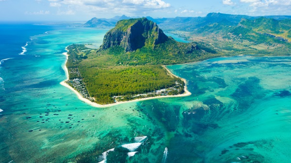
From Heartland Daily News
A spate of recent articles acknowledges a fact that Climate Realism has long discussed. Most island nations, rather than sinking beneath the waves as seas rise amid modest warming, as predicted by climate alarmists and island profiteers, are, in fact growing.
Writing for The Pipeline, Buck Throckmorton thoroughly debunks claims that recent collapses of houses built on the shores of barrier islands in North Carolina were caused by climate change:
[B]arrier islands … are impermanent deposits of sand, which reshape, move, merge, appear, and disappear due to tides, winds, and storms.
The movement of barrier islands is not due to rising sea levels, it is due to a naturally occurring force called “longshore drift.” Where there are man-made efforts to stabilize barrier islands with jetties and sea walls, this produces other impacts on currents that cause erosion in some waterfront areas and new sand deposits in others. Beach houses in the Outer Banks are not being lost due to rising sea levels, they are being lost due to shifting sands.
Throckmorton also pointed to the disappearance of Tucker’s Island, off the coast of New Jersey, which completely disappeared due to “long-shore drift,” not rising seas.
NOAA describes the impact of long-shore drift, thusly:
Longshore drift may also create or destroy entire barrier islands along a shoreline. A barrier island is a long offshore deposit of sand situated parallel to the coast. As longshore drifts deposit, remove, and redeposit sand, barrier islands constantly change.
Semi-permanent, shifting barrier islands are not the only types of islands not being destroyed by climate change-induced rising seas. Even The New York Times (NYT) was recently forced by reality to admit that coral atolls, long the poster child of rising seas claiming nations, have been expanding and adding land amidst the Earth’s slight recent warming.
As recently as April 2024, with a story titled “Why Time Is Running Out Across the Maldives’ Lovely Little Islands,“ the NYT was still pushing the lie that rising seas threaten dozens of island nations, consisting of hundreds of small coral atolls, with extinction. Reality forced the NYT to reverse itself in the space of just three months. The author of a late June article, “A Surprising Climate Find,” wrote:
Of late, though, scientists have begun telling a surprising new story about these islands. By comparing mid-20th century aerial photos with recent satellite images, they’ve been able to see how the islands have evolved over time. What they found is startling: Even though sea levels have risen, many islands haven’t shrunk. Most, in fact, have been stable. Some have even grown.
The problem with this narrative is that the fact of growing islands during the recent period of climate change is not new news. In fact, as my colleague Linnea Lueken noted in a recent piece, the study the NYT references was published in 2018, six years ago. It found 89 percent of islands in the Pacific and Indian Oceans increased in area or were stable, and only 11 percent showed any sign of contracting.
Indeed, geological understanding of coral atoll growth and demise is not newly discovered.
“Scientists have known for decades, if not more than a hundred years, that atoll islands uniquely change with changing sea levels,” Lueken points out. “Charles Darwin was the first to propose that reefs were many thousands of feet thick, and grow upwards towards the light. He was partially correct, though reality is more complicated than his theory.”
Repeated studies show that what is true of the Maldives, growth amid rising seas, is equally true of the islands that make up Tuvalu and Kiribati, and across the island chains of Micronesia. One well-cited study from 2015 reported that 40 percent of islands in the Pacific and Indian Oceans were stable, and another 40 percent had grown, in recent decades.
Oceans, oceans everywhere, and nowhere can be found the much-bemoaned decline in island nations hyped be climate hucksters with regularity. When even the NYT is forced to admit this truth, you know the climate alarm narrative is in trouble.
Sources: The Pipeline; The New York Times; Climate Realism
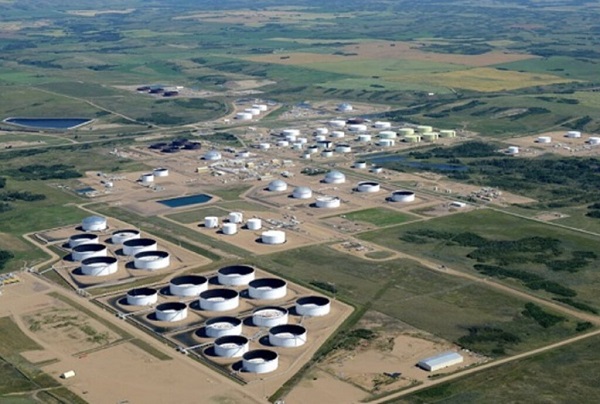
Wapisiw Lookout, reclaimed site of the oil sands industry’s first tailings pond, which started in 1967. The area was restored to a solid surface in 2010 and now functions as a 220-acre watershed. Photo courtesy Suncor Energy
From the Canadian Energy Centre
By CEC Research
Mines demonstrate significant strides through technological innovation
Tailings are a byproduct of mining operations around the world.
In Alberta’s oil sands, tailings are a fluid mixture of water, sand, silt, clay and residual bitumen generated during the extraction process.
Engineered basins or “tailings ponds” store the material and help oil sands mining projects recycle water, reducing the amount withdrawn from the Athabasca River.
In 2023, 79 per cent of the water used for oil sands mining was recycled, according to the latest data from the Alberta Energy Regulator (AER).
Decades of operations, rising production and federal regulations prohibiting the release of process-affected water have contributed to a significant accumulation of oil sands fluid tailings.
The Mining Association of Canada describes that:
“Like many other industrial processes, the oil sands mining process requires water.
However, while many other types of mines in Canada like copper, nickel, gold, iron ore and diamond mines are allowed to release water (effluent) to an aquatic environment provided that it meets stringent regulatory requirements, there are no such regulations for oil sands mines.
Instead, these mines have had to retain most of the water used in their processes, and significant amounts of accumulated precipitation, since the mines began operating.”
Despite this ongoing challenge, oil sands mining operators have made significant strides in reducing fluid tailings through technological innovation.
This is demonstrated by reductions in “legacy fluid tailings” since 2015.
Legacy Fluid Tailings vs. New Fluid Tailings
As part of implementing the Tailings Management Framework introduced in March 2015, the AER released Directive 085: Fluid Tailings Management for Oil Sands Mining Projects in July 2016.
Directive 085 introduced new criteria for the measurement and closure of “legacy fluid tailings” separate from those applied to “new fluid tailings.”
Legacy fluid tailings are defined as those deposited in storage before January 1, 2015, while new fluid tailings are those deposited in storage after January 1, 2015.
The new rules specified that new fluid tailings must be ready to reclaim ten years after the end of a mine’s life, while legacy fluid tailings must be ready to reclaim by the end of a mine’s life.
Total Oil Sands Legacy Fluid Tailings

Alberta’s oil sands mining sector decreased total legacy fluid tailings by approximately 40 per cent between 2015 and 2024, according to the latest company reporting to the AER.
Total legacy fluid tailings in 2024 were approximately 623 million cubic metres, down from about one billion cubic metres in 2015.
The reductions are led by the sector’s longest-running projects: Suncor Energy’s Base Mine (opened in 1967), Syncrude’s Mildred Lake Mine (opened in 1978), and Syncrude’s Aurora North Mine (opened in 2001). All are now operated by Suncor Energy.
The Horizon Mine, operated by Canadian Natural Resources (opened in 2009) also reports a significant reduction in legacy fluid tailings.
The Muskeg River Mine (opened in 2002) and Jackpine Mine (opened in 2010) had modest changes in legacy fluid tailings over the period. Both are now operated by Canadian Natural Resources.
Imperial Oil’s Kearl Mine (opened in 2013) and Suncor Energy’s Fort Hills Mine (opened in 2018) have no reported legacy fluid tailings.
Suncor Energy Base Mine

Between 2015 and 2024, Suncor Energy’s Base Mine reduced legacy fluid tailings by approximately 98 per cent, from 293 million cubic metres to 6 million cubic metres.
Syncrude Mildred Lake Mine

Between 2015 and 2024, Syncrude’s Mildred Lake Mine reduced legacy fluid tailings by approximately 15 per cent, from 457 million cubic metres to 389 million cubic metres.
Syncrude Aurora North Mine

Between 2015 and 2024, Syncrude’s Aurora North Mine reduced legacy fluid tailings by approximately 25 per cent, from 102 million cubic metres to 77 million cubic metres.
Canadian Natural Resources Horizon Mine

Between 2015 and 2024, Canadian Natural Resources’ Horizon Mine reduced legacy fluid tailings by approximately 36 per cent, from 66 million cubic metres to 42 million cubic metres.
Total Oil Sands Fluid Tailings
Reducing legacy fluid tailings has helped slow the overall growth of fluid tailings across the oil sands sector.
Without efforts to reduce legacy fluid tailings, the total oil sands fluid tailings footprint today would be approximately 1.6 billion cubic metres.
The current fluid tailings volume stands at approximately 1.2 billion cubic metres, up from roughly 1.1 billion in 2015.

The unaltered reproduction of this content is free of charge with attribution to the Canadian Energy Centre.
Energy
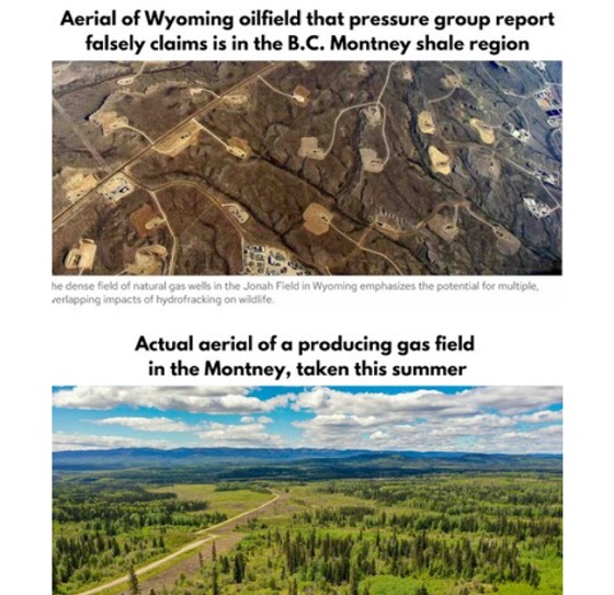
B.C. Residents File Competition Bureau Complaint Against David Suzuki Foundation for Use of False Imagery in Anti-Energy Campaigns
From Energy Now and The Canadian Newswire
A group of eight residents of Northeast British Columbia have filed a formal application for inquiry with Canada’s Competition Bureau, calling for an investigation into the David Suzuki Foundation’s (the Foundation) use of false and misleading imagery in its anti-energy campaigns.
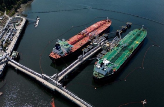
The complaint alleges that the Foundation has repeatedly used a two-decade-old aerial photograph of Wyoming gas wells to falsely depict modern natural gas development in B.C.’s Montney Formation. This area produces roughly half of Canada’s natural gas.
")

Key Facts:
- The misleading image has been used on the Foundation’s website, social media pages, reports and donation appeals.
- The Foundation has acknowledged the image’s true source (Wyoming) in some contexts but has continued to use it to represent B.C. development.
- The residents claim this materially misleads donors and the public, violating Section 74.01(1) of the Competition Act.
- The complaint is filed under Sections 9 and 10 of the Act, asking the Bureau to investigate and impose remedies including ceasing the conduct, publishing corrective notices, and returning proceeds.
Quote from Deena Del Giusto, Spokesperson:
“This is about fairness and truth. The people of Northeast B.C. are proud of the work they do to produce energy for Canada and the world. They deserve honest debate, not scare tactics and misleading imagery used to raise millions in donations. We’re asking the Competition Bureau to hold the David Suzuki Foundation to the same standard businesses face: tell the truth.”
Background:
Natural gas development in the Montney Formation supports thousands of jobs and fuels economic activity across the region. Accurate public information is vital to informed debate, especially as many Canadians live far from production sites.
SOURCE Deena Del Giusto


RFK Jr. says Hep B vaccine is linked to 1,135% higher autism rate
Alberta Independence Seekers Take First Step: Citizen Initiative Application Approved, Notice of Initiative Petition Issued

RFK Jr. Unloads Disturbing Vaccine Secrets on Tucker—And Surprises Everyone on Trump

National Health Care Fraud Takedown Results in 324 Defendants Charged in Connection with Over $14.6 Billion in Alleged Fraud

-
 Alberta2 days ago
Alberta Provincial Police – New chief of Independent Agency Police Service
-
 Business2 days ago
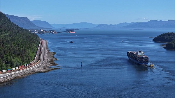
Why it’s time to repeal the oil tanker ban on B.C.’s north coast
-
 Energy2 days ago
If Canada Wants to be the World’s Energy Partner, We Need to Act Like It
-
 International2 days ago
CBS settles with Trump over doctored 60 Minutes Harris interview
-
 Alberta2 days ago
Pierre Poilievre – Per Capita, Hardisty, Alberta Is the Most Important Little Town In Canada
-
 Aristotle Foundation2 days ago
How Vimy Ridge Shaped Canada
-
 Alberta1 day ago
Alberta uncorks new rules for liquor and cannabis
-
Canadian Energy Centre1 day ago
Alberta oil sands legacy tailings down 40 per cent since 2015