Agriculture
New documentary ‘Nitrogen 2000’ exposes the Dutch government’s war on farmers
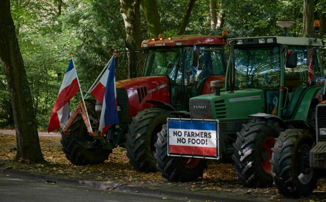
Tractors belonging to Dutch farmers are parked with protest boards and Dutch flags upside down on a road on the outskirts of The Hague on September 20, 2022, in The Hague, Netherlands
From LifeSiteNews
Ultimately, the documentary highlights a power struggle where fear and environmental narratives are used to justify land control, leaving farmers marginalized and resources controlled by a select few.
STORY AT-A-GLANCE
- Dutch cattle farmers own 70 percent of Holland, but the government is pushing for a forced buy out of 50 percent of their land, claiming it’s necessary to reduce pollution.
- Experts say the move to get rid of farmers isn’t about the environment but, rather, taking control of valuable land.
- The government’s computer models, which are used to support its plan to reduce nitrogen by buying up farmland, are based on a flawed assumption that nitrogen migrates from one field to the next.
- The push to remove farmers from their land is being driven by NGOs, which are primarily funded by the government, making them government extensions.
- A $25 billion government fund, created using taxpayers’ money, has been established to buy farmers’ land; once a farmer sells their land, they’ll be legally prohibited from establishing a farm anywhere else in Europe.
(Mercola) — Nitrogen 2000 is an important 45-minute documentary on the Dutch farmer struggle of 2019-23. Dutch cattle farmers own 70 percent of Holland, but in 2019, the government began pushing for a forced buyout of 50 percent of their land, claiming it’s necessary to reduce pollution. But for the approximately 60,000 farmers in the Netherlands, agriculture is a way of life, often passed down through the generations – one that’s necessary to supply food for the population.
According to a press release for the film, “Dutch farmers produce the most food per hectare of farmers anywhere, and the Netherlands is the world’s second largest exporter of agricultural products.”
Farms are interwoven into the fabric of their communities, such that “everyone, even if you live in the city like in Amsterdam or in Rotterdam, in a five-minute drive you will see cows, you will see farmland… it’s so ingrained in our society, in our way of life, that farmers are part of our culture. Everyone has someone in their family who was once a farmer,” says political commentator Sietske Bergsma.
But as professor Han Lindeboom, a marine ecologist at Wageningen University & Research, explains in the film, “The government has taken the stance that we have a huge problem with nature and that due to EU regulations we should save nature. And nowadays we want to solve that problem by simply eliminating a large amount of farms.”
The Dutch government claims it needs to nationalize half of cattle farmers’ land – an amount equal to about one-third of Holland – in order to reduce nitrogen, but experts say this plan is seriously flawed.
Is nitrogen really the problem?
Carbon and nitrogen have been declared environmental enemies by officials worldwide, prompting an array of restrictions. The U.N. has stated that nitrogen must be managed in order to save the planet, and nitrogen is described as “one of the most important pollution issues facing humanity.” Nitrogen not only is found in fertilizers, but it also makes up about 70 percent of air and is essential for plant growth.
“The nitrogen is only a problem for a few plants,” Lindeboom explains. “There are certain plants that don’t like it and they disappear. Other plants like it and they appear. So, basically what you’re doing is changing nature.”
“They have declared that nitrogen is the major problem,” Lindeboom, an adviser to NIOZ, the Royal Netherlands Institute for Sea Research, continues in the press release. “Well, I am an expert in nitrogen and I dare to say it is not.” According to Lindeboom, the government’s computer models, which are used to support its plan to buy up farmland, are based on a flawed assumption that nitrogen migrates from one field to the next.
The EU is also the site of the largest network of protected areas globally, an area known as Natura 2000, which covers 18 percent of EU land. In Holland alone, there are 162 Natura 2000 areas. In 118 of them, it’s said there are organisms living that don’t like too much nitrogen.
“In 2021, the European Union’s Natura 2000 network released a map of areas in the Netherlands that are now protected against nitrogen emissions. Any Dutch farmer who operates their farm within 5 kilometers of a Natura 2000 protected area would now need to severely curtail their nitrogen output, which in turn would limit their production,” Roman Balmakov, Epoch Times reporter and host of “Facts Matter,” says.
Government forcing out farmers
Many Dutch farmers are now facing the loss of their farms over the controversial nitrogen rules. Farmer Jos Block says:
We have a lot of problems with the nitrogen rules because our farm is near to and in Natura 2000. And that is really a problem for us. This is my land. I’m the owner. But this is also a nature land, the Natura 2000. In this area, the government says we need to reduce 95% of the nitrogen that’s coming out of the stables.
But experts, including Lindeboom, say this is “absolutely not necessary to save nature” and the government is “picking on farmers much too much.” Dutch dairy farmer Nynke Koopmans with the Forum for Democracy is among those who believe the nitrogen problem is made up.
“It’s one big lie,” she says. “The nitrogen has nothing to do with environment. It’s just getting rid of farmers.” Another farmer said if new nitrogen rules go into effect, he’d have to reduce his herd of 58 milking cows down to six. Nitrogen scientist Jaap C. Hanekamp, Ph.D., was working for a government committee to study nitrogen, tasked with analyzing the government’s nitrogen model. He told Balmakov:
The whole policy is based on the deposition model about how to deal with nitrogen emissions on nature areas. And I looked at the validation studies and show that the model is actually crap. It doesn’t work. And doesn’t matter. They still continue using it. Which is, in a sense, unsettling. I mean, really, can we do such a thing in terms of policy? Use a model which doesn’t work? It’s never about innovation, it’s always about getting rid of farmers.
The Dutch government has been gradually tightening its grasp on farmers for some time. Every year, farmers must report details about the number of cows they farm and how many they plan to have in the future. The government also dictates what types of crops farmers grow and requires complicated and expensive manure testing for phosphates and ammonia, driving up farmers’ costs and reducing their income.
Government-funded NGOs are lobbying to get rid of farmers
The push to remove farmers from their land is being driven by NGOs, which are primarily funded by the government, making them government extensions. A $25 billion government fund, created using taxpayers’ money, has also been established to buy farmers’ land.
Once a farmer sells their land, they’ll be legally prohibited from establishing a farm anywhere else in Europe. Meanwhile, the NGOs may even end up farming the land once they’ve pushed the farmer out of the picture. According to the film’s press release:
NGOs – namely Dierenbescherming, Varkens in Nood, Greenpeace, Vogelbescherming, Natuurmonumenten – are the primary organizations lobbying for the nitrogen policy. Their budget is funded by the Dutch government. Once a farmer is bought out, the NGOs become custodians of the land and, in some cases, put cows back on the land to manage it.
Commenting on this policy, farmer Bolk said, ‘I do the same as the nature organizations in Holland… I think it’s very strange that a farmer is not allowed to do it but a nature organization can do the same as I do and then there is no nitrogen problem.’
The real agenda, however, may be traced back to the Club of Rome, a think tank that aligned with neo-malthusianism – the idea that an overly large population would decimate resources – and was intending to implement a global depopulation agenda.
“They came up with this incredible document where they actually said, ‘We need a new justification for this all-powerful state,’” international journalist Alex Newman says. “So, the new excuse is going to be because the environment is going to be harmed and because climate is going to hurt us.” Balmakov continues:
I could not believe what I just heard, that world leaders really laid out this globalist plan in plain English in a physical book, way back in 1991. I went on Amazon. And there it was.
‘The First Global Revolution,’ which states, and I quote, ‘In searching for a common enemy to unite us, we came up with the idea that pollution, the threat of global warming, water shortages, famine, and the like, would fit the bill. And therefore, the real enemy is humanity itself.’
In its quest to reduce nitrogen, the Dutch government is targeting farmers, not industry, such as brick factories, which also produce nitrogen to build new houses. The reason, many believe, lies in the land itself.
Is the nitrogen crisis a cover for land control?
Innovative farming methods and changes in food can reduce livestock emissions. But even when farmers have told the government they’d get rid of their cows – just not their land – the government refused.
“Under the guise of democracy and liberalism, they are taking away rights,” political commentator Sietske Bergsma says. “And most people are fine with it because they feel this sort of responsibility – maybe because it’s so ‘progressive’ to care about the climate – so they’re willing to actually sacrifice their own well-being.”
The narrative is based on fear and telling people what they must do in order to be safe. “We’ve paid a really high price for this because we gave up all our freedoms to feel safe,” Bergsma adds. “And obviously this safety is also very fake because you can’t be safe without being free. It’s not about saving the planet. It’s about government control because that’s in effect what is happening.”
Once the farmers are pushed out, globalists suggest eating bugs will protect the planet by eliminating the need for livestock, cutting down on agricultural land use and protecting the environment. The U.N.’s Food and Agriculture Organization also encourages the consumption of insects and insect-based foods, and the momentum to get farmers off their land is continuing to gain steam.
In 2023, the European Commission approved two Dutch schemes to buy out farmers’ land. While some farmers staged protests against the plans to reduce nitrogen emissions, more than 750 Dutch farmers had signed up for the buy-out scheme as of November 2023, with about 3,000 expected to be eligible for the program. Similar programs are also being discussed in Canada, Ireland, and the U.S. But ultimately, as environmental journalist Rypke Zeilmaker explains:
It’s not about nature protection. Only the ones who, in this process, have acquired the most money will have the ruling power. It comes down to control of resources in the hands of the few. Look at the power of the NGOs. Who do they really support? Who’s pumping money into them? It’s always governments and billionaires doing it…
So, this is the relation between government and NGOs. To an extent you can sell the public. You can buy the public opinion… It’s all about fear. It’s about making people fear for the future so that they would agree with policies that, if they are sober, they would never agree with.
Reprinted with permission from Mercola.
Agriculture
Lacombe meat processor scores $1.2 million dollar provincial tax credit to help expansion
Alberta’s government continues to attract investment and grow the provincial economy.
The province’s inviting and tax-friendly business environment, and abundant agricultural resources, make it one of North America’s best places to do business. In addition, the Agri-Processing Investment Tax Credit helps attract investment that will further diversify Alberta’s agriculture industry.
Beretta Farms is the most recent company to qualify for the tax credit by expanding its existing facility with the potential to significantly increase production capacity. It invested more than $10.9 million in the project that is expected to increase the plant’s processing capacity from 29,583 to 44,688 head of cattle per year. Eleven new employees were hired after the expansion and the company plans to hire ten more. Through the Agri-Processing Investment Tax Credit, Alberta’s government has issued Beretta Farms a tax credit of $1,228,735.
“The Agri-Processing Investment Tax Credit is building on Alberta’s existing competitive advantages for agri-food companies and the primary producers that supply them. This facility expansion will allow Beretta Farms to increase production capacity, which means more Alberta beef across the country, and around the world.”
“This expansion by Beretta Farms is great news for Lacombe and central Alberta. It not only supports local job creation and economic growth but also strengthens Alberta’s global reputation for producing high-quality meat products. I’m proud to see our government supporting agricultural innovation and investment right here in our community.”
The tax credit provides a 12 per cent non-refundable, non-transferable tax credit when businesses invest $10 million or more in a project to build or expand a value-added agri-processing facility in Alberta. The program is open to any food manufacturers and bio processors that add value to commodities like grains or meat or turn agricultural byproducts into new consumer or industrial goods.
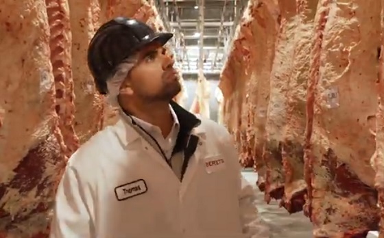
Beretta Farms’ facility in Lacombe is a federally registered, European Union-approved harvesting and meat processing facility specializing in the slaughter, processing, packaging and distribution of Canadian and United States cattle and bison meat products to 87 countries worldwide.
“Our recent plant expansion project at our facility in Lacombe has allowed us to increase our processing capacities and add more job opportunities in the central Alberta area. With the support and recognition from the Government of Alberta’s tax credit program, we feel we are in a better position to continue our success and have the confidence to grow our meat brands into the future.”
Alberta’s agri-processing sector is the second-largest manufacturing industry in the province and meat processing plays an important role in the sector, generating millions in annual economic impact and creating thousands of jobs. Alberta continues to be an attractive place for agricultural investment due to its agricultural resources, one of the lowest tax rates in North America, a business-friendly environment and a robust transportation network to connect with international markets.
Quick facts
- Since 2023, there are 16 applicants to the Agri-Processing Investment Tax Credit for projects worth about $1.6 billion total in new investment in Alberta’s agri-processing sector.
- To date, 13 projects have received conditional approval under the program.
- Each applicant must submit progress reports, then apply for a tax credit certificate when the project is complete.
- Beretta Farms has expanded the Lacombe facility by 10,000 square feet to include new warehousing, cooler space and an office building.
- This project has the potential to increase production capacity by 50 per cent, thereby facilitating entry into more European markets.
Related information
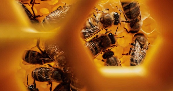
Canada’s Bee Apocalypse began in 2008. That was the year the Canadian Association of Professional Apiculturists (CAPA) first reported unusually high rates of winter bee colony losses. At 35 percent, the winter die-off that year was more than twice the normal 15 percent rate of attrition.
“Successive annual losses at [these] levels … are unsustainable by Canadian beekeepers,” the CAPA warned. This set off an avalanche of dire media reports that now appear on a regular basis. Among the many examples over the years: Huge Honey Bee Losses Across Canada” and “Canada’s bee colonies see worst loss in 20 years”. As each of these stories reminds readers, the disappearance of honey bees will doom our food supply, given their crucial role in pollinating crops including canola, soyabeans, apples, tomatoes and berries.
This year the black-and-yellow striped Cassandras are back at work, with headlines shouting “Scientists warn of severe honeybee losses in 2025” and “The Bees are Disappearing Again”. If it’s spring, the bees must be disappearing. Again.
It is, however, mathematically impossible for any species to be in an allegedly continuous and calamitous state of decline over nearly two decades and never actually reduce in number. For despite the steady supply of grave warnings regarding their imminent collapse, Canada’s bees are actually buzzing with life.
In 2007, according to Statistics Canada, there were 589,000 honey bee colonies in Canada,; in 2024, they reached 829,000, just shy of 2021’s all-time high of 834,000. Figuring a conservative summertime average of 50,000 bees per colony, that means there are approximately 12 billion more honey bees in Canada today than when the Bee Apocalypse first hit.
As for beekeepers, their numbers have also been growing steadily, and now stand at 15,430 – the most recorded since 1988. As CAPA’s report acknowledges, “the Canadian beekeeping industry has been resilient and able to grow, as proven by the overall increase in the number of bee colonies since 2007 despite the difficulties faced every winter.”
How is this possible? As is usually the case where there’s a need to be filled, the market holds the answer.
It is true that Canadian honey bees face a long list of threats and challenges ranging from mites and viruses to Canada’s harsh winters. It is also true that they perform a crucial service in pollinating crops, the value of which is estimated at $7 billion annually. However, this underscores the fact that bees are a livestock bred for a particular agricultural purpose, no different from cattle, chickens or pen-raised salmon. They are a business.
And in spite of its alleged status as an environmental totem, the honey bee isn’t even native to North America. It was first imported by European settlers for its honey-making abilities in the 1600s. Since then, it has been cultivated with deliberate commercial intent – allowing it to outcompete native pollinators such as bumble bees and butterflies even though it is poorly suited to the local winter. (This highlights the irony of all those native-plant pollinator gardens virtuously installed in neighbourhoods across Canada that end up supporting an invasive honey bee population.)
The significance of the bee economy means that when a beehive collapses over the winter for whatever reason, beekeepers have plenty of motivation to regenerate that colony as swiftly as possible. While hives can create their own queens over time, this can be a slow process given the cold Canadian climate. The better option is to simply buy a new queen from a warmer country.
In 2024, Canada imported 300,000 queens worth $12 million, mostly from the U.S., Italy, Australia and Chile. That works out to $40 each. In a miracle of nature, each of these new queens can lay up to 2,500 eggs a day, and each egg takes just two to three weeks to reach full maturity as a worker or drone. It is also possible to import entire “bee packages” that include a queen and 8,000 to 10,000 bees.
As a result, even a devastating 50 percent winter loss rate, something that has occurred only rarely in Canada in individual provinces and never nationally, isn’t necessarily fatal to any beekeeping operation. The beekeeper can purchase imported queens in April, split their existing colonies and be back in business by May or June.
And regardless of the honey bee’s apparent difficulties with Canada’s unforgiving weather (efforts are ongoing to breed a hardier Canadian variant), there’s no shortage of bees worldwide. Earlier this year, the German statistical agency reported the global beehive count rose from 69 million in 1990 to 102 million in 2023. Another study looking back to 1961 by New Zealand researchers found the number of honey bee colonies has “nearly doubled” over this time, while honey production has “almost tripled.” As the New Zealand report observes, “Headlines of honey bee colony losses have given an
impression of large-scale global decline of the bee population that endangers beekeeping, and that the world is on the verge of mass starvation.” Such claims, the authors note, are “somewhat inaccurate.” In truth, things have never been better for bees around the world.
Here in Canada, the ability to import queens from other countries, together with their prodigious reproductive capabilities, backstops the amazing resiliency of the bee industry. Yes, bees die. Sometimes in large numbers. But – and this is the bit the headlines always ignore – they come back. Because the market needs them to come back.
If there is a real threat to Canada’s bee population, it’s not environmental. It’s the risk that unencumbered trade in bees might somehow be disrupted by tariffs or similar bone-headed human interventions. Left on their own, bees have no problem keeping busy.
The longer, original version of this story first appeared at C2CJournal.ca


Before Trudeau average annual immigration was 617,800. Under Trudeau number skyrocketted to 1.4 million annually

FDA requires new warning on mRNA COVID shots due to heart damage in young men

Canada’s euthanasia regime is already killing the disabled. It’s about to get worse
Blackouts Coming If America Continues With Biden-Era Green Frenzy, Trump Admin Warns

-
 Addictions1 day ago
Why B.C.’s new witnessed dosing guidelines are built to fail
-
 Frontier Centre for Public Policy2 days ago
Canada’s New Border Bill Spies On You, Not The Bad Guys
-
 Business1 day ago
Carney Liberals quietly award Pfizer, Moderna nearly $400 million for new COVID shot contracts
-
 Energy2 days ago
CNN’s Shock Climate Polling Data Reinforces Trump’s Energy Agenda
-
 Opinion1 day ago
Preston Manning: Three Wise Men from the East, Again
-
 Opinion1 day ago
Charity Campaigns vs. Charity Donations
-
 Business1 day ago
Mark Carney’s Fiscal Fantasy Will Bankrupt Canada
-
 COVID-191 day ago
Trump DOJ dismisses charges against doctor who issued fake COVID passports