Travel
Todayville Travel: Part 3 of Gerry’s Yukon Road Trip

Last in a 3-part series on a Yukon road trip – Mt. Logan – Kluane National Park
by Gerry Feehan
“You’re not going to believe this. Sian called again. It’s just cleared up at base camp and the radar report looks good. It’s a go if you’re still willing.”
I’ve been a geography nut since I was a kid. My noggin is full of useless facts. In pre-metric days I memorized details of the world’s highest and lowest: Mount Everest 29,028 feet, Challenger Deep in the Mariana Trench 35,814 feet. As a proud Canadian I knew that our highest peak, Mt. Logan in Yukon’s Kluane National Park, topped out at 19,850 feet above sea level. To my chagrin, North America’s highest reach, 20,320-foot-high Mt McKinley, was located across the border in Alaska. As usual, America had outdone us, even at something as Canadian as rock, snow and ice.

I’ve always wanted to see Mt. Logan. We were nearing the end of our six-week-long Yukon road-trip. The highway would take us through Kluane National Park, so I made inquiries. A Whitehorse friend told me it was possible to organize a flight from Kluane Lake into Logan base camp. The camp is on a glacier in the heart of the St. Elias Mountains, a vast roadless, uninhabitable wilderness.
Sian Williams and her partner Lance Goodwin operate Icefield Discovery near Haines Junction, Yukon on beautiful Kluane Lake. I called early in June to book a day-trip. Sian (pronounced “Shan” – a Welsh name chosen by her bush-pilot father Andy) told me that due to spring’s late arrival they’d been unable to access the camp located on Kaskawulsh Glacier beneath Mt. Logan. She added that the long-term forecast was poor. I was crest-fallen. We were booked to leave the North by ferry on June 21, the summer solstice.
We arrived in Kluane National Park with only a two-day window of opportunity. I checked in with Lance. He wasn’t optimistic. Sian had flown into the camp a week earlier and been stuck there, socked in by a brutal snowstorm. Kluane’s mountainous terrain means that all access is by air. And this region is too dangerous and unforgiving to rely solely on instruments so visual flight rules are always in force. No see, no fly.

We sat put, waiting for the mountain weather gods to calm. Our first night, camped on the shore of frigid Kluane Lake, we enjoyed a repast of fresh Arctic Grayling (supplied courtesy of my fly rod). Meters away a grizzly bear, terrifying claws in close-up view, combed the beach in search of its own fishy catch. The next day we spent cautiously hiking an alpine ridge, bear aware. Fortunately we shared the pristine view with only mountain sheep, moose and caribou.
As we set off she pointed to a gaping cobalt scar part way up the snowfield, “Watch out for the crevasse.” We set course accordingly.

A grizzly set of claws
The morning arrived when we needed to make a move for the coast. The solstice was nigh. I phoned Lance and he said, “I spoke to Sian on the satellite phone. It’s still a whiteout up there. Sorry.” We reluctantly packed camp and were on our way south when Lance rang back, “You’re not going to believe this. Sian called again. It’s just cleared up at base camp and the radar report looks good. It’s a go if you’re still willing.”
We high-tailed it for the Kluane airstrip where we met Donjek, the pilot. He was born here, named after the Donjek River that flows into Kluane (naturally his father was also a bush pilot). As we took off, the plane’s shrinking shadow followed us across the emerald beauty of Kluane Lake. Soon the lake gave way to a snaking, silt-laden river. We gained elevation and the dirty toe of Kaskawulsh glacier appeared. Then all was ice; white curving fingers spilling from mountain valleys. Dark lines of ground rock defined the course of each icy highway. Then all became snow, the line between earth and sky indiscernible.

The airplane shadows Kluane’s emerald waters

Kaskawulsh Glacier
We flew over the camp. Sian waved from below, a tiny solitary figure surrounded by white glacial enormity. Mt Logan, draped in sun and cloud, stood imperiously in the background. Donjek lowered the skis of the Helio-Courier prop plane and we skidded to a smooth stop.

A landing on skis

Sian had spent nearly a week alone on the glacier
We climbed from the cockpit and walked through virgin snow to where Sian was standing in a deep pit, shovel in hand. It looked like she was cutting blocks for an igloo. Actually she was retrieving the prior season’s camp from burial under three meters of winter snow pack. (That’s how glaciers grow – year upon year of accumulated snowfall eventually compressing into ice. At Logan base camp the ice is over a kilometer thick.)

Donjek helps to dig out last year’s camp
We helped Sian haul a heavy tent from its deep winter interment. She suggested we hike over the glacier to a viewpoint framing Mt. Logan. As we set off she pointed to a gaping cobalt scar part way up the snowfield, “Watch out for the crevasse.” We set course accordingly.

The glacier toe
When we returned Sian boiled water for tea and chatted about the inner workings of glaciers and their role in hydrology, geography and world climate. Icefield Discovery’s headquarters, on Kluane Lake, house the Arctic Institute of North America, which conducts glacier research.
We were in the heart of the world’s largest non-polar ice field. Due to its proximity to the warmer, lower Kluane valley and nearby Whitehorse, the St. Elias region is ideal for ice-core sampling and Arctic-style exploration. Canada’s other, more northerly polar arctic regions are less accessible and more inhospitable.

Don’t forget your sunscreen!
After three sun-drenched hours on the glacier Donjek fired up the prop and we skied off into the airy abyss, down the dirty winding glacial trail and back into the summer greenery of Kluane Lake. It was late in the day when we finally climbed into our RV and started south for Haines, Alaska, three-hundred kilometers away on the coast. Along the way, colorful pink Yukon wildflowers contrasted with the snowy splendor of Kluane’s mountains – as did my beet-red, fried face. I’d forgotten to apply sunscreen.

Yukon wildflowers
Near midnight we arrived in Haines, located in a narrow spit on a scenic Alaskan fjord. As we set up camp a wildlife ballet greeted us. Two brown bears were dancing, performing a grizzly twilight duet. Behind them across the spit, like curtains on a stage, two majestic waterfalls cascaded into the ocean.

A Grizzly midnight waltz
In the morning we awoke with the solstice. Summer had arrived. Our ferry departure was nigh.

A glacier highway
For a final boreal treat we rode our bikes through a coastal rainforest. Dwarfed by thousand-year old giants, we crested a hill in the dappled forest and came upon a large group of Japanese tourists, walking single-file. Each sported a pair of white gloves and what looked like a beekeeper’s hat. As we rode by, one by one they broke into spontaneous applause – golf-clap style. On occasion life is surreal.
Gerry Feehan QC is an award-winning travel writer and photographer. He and his wife Florence live in Red Deer, AB and Kimberley, BC.

Thanks to these amazing local companies who make Todayville Travel possible.


Click below to read Part 1 in Gerry’s 3-part series on the Yukon.

Click below to read Part 2 in Gerry’s 3-part series on the Yukon.

Click here to visit our Travel section and see more of Gerry’s stories.
 MxM News
Quick Hit:
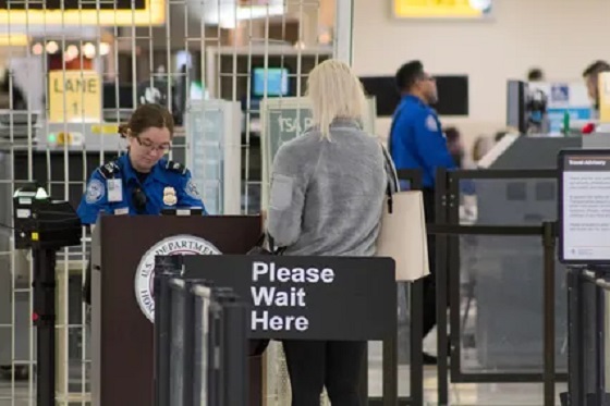
The Trump administration is phasing out one of the most despised airport security policies in America: the requirement to remove shoes during TSA screening.
Key Details:
- Passengers will no longer be required to remove their shoes at airport security checkpoints in coming weeks.
- The change is rolling out at Baltimore, Fort Lauderdale, Cincinnati, Portland, Philadelphia, and Piedmont Triad airports.
- White House Press Secretary Karoline Leavitt confirmed the policy reversal on Tuesday morning.
Diving Deeper:
The Trump administration announced it is ending the much-loathed Transportation Security Administration rule requiring passengers to remove their shoes during security checks, a mandate that has frustrated Americans since its introduction nearly two decades ago.
The change is being implemented first at Baltimore/Washington International Airport, Fort Lauderdale International Airport, Cincinnati/Northern Kentucky International Airport, Portland International Airport, Philadelphia International Airport, and Piedmont Triad International Airport in North Carolina, according to CBS News. The policy will expand to additional airports nationwide in the coming weeks.
White House Press Secretary Karoline Leavitt shared the news on X, posting, “Big news from [the Department of Homeland Security]!” Tuesday morning. A TSA spokesman told The New York Times that “TSA and DHS are always exploring new and innovative ways to enhance the passenger experience and our strong security posture,” suggesting the policy change is part of broader improvements under President Trump’s leadership.
The policy to remove shoes was first instituted in 2006, stemming from the December 2001 attempt by Richard Reid, known as the “shoe bomber,” to ignite explosives hidden in his shoes on a flight from Paris to Miami. Reid was sentenced to life in prison after pleading guilty to terrorism charges, but critics have argued the policy punishes every American traveler for the actions of one terrorist nearly 25 years ago.
Before the update, travelers in the TSA PreCheck program were already exempt from removing shoes, belts, and jackets. Now, under President Trump’s directive to reduce pointless regulatory burdens, the policy is being eliminated for all travelers.
From the Fraser Institute
By Alex Whalen and Jake Fuss
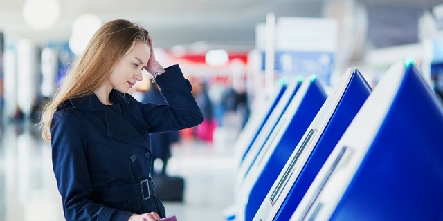
While the strike by WestJet mechanics lasted only a few days, many Canadian air travellers faced long delays and cancelled flights. More broadly, according to the Canadian Transportation Agency, customer complaints have hit an all-time high.
Yet many dissatisfied travellers likely don’t realize that Ottawa heavily contributes to their frustrations. Let’s look at the various ways federal policies and laws make air travel worse in Canada.
First, federal laws insulate Canada’s airlines from competition. Foreign airlines are subject to highly restrictive “cabotage” laws which, for example, dictate that foreign airlines cannot operate routes between Canadian cities. At the same time, foreign investors are forbidden from owning more than 49 per cent of Canadian airlines. By restricting international participation in the Canadian air travel market, these laws both deprive Canadian consumers of choice and insulate incumbent airlines from competition. When consumers have more choice, incumbents have a greater incentive to improve performance to keep pace with their competitors.
Second, a wide array of taxes and fees heavily influence the cost of airline tickets in Canada. Airport improvement fees, for example, average $32.20 per departing passenger at airports in Canada’s 10 largest markets. In contrast, airport improvement fees in the United States cannot exceed $4.50. And last year the Trudeau government increased the “air travellers security charge” by 32.85 per cent—this fee, which now ranges from $9.94 to $34.82 per flight, is higher in Canada than the U.S. across all flight categories. On the tax front, in addition to fuel taxes including the federal carbon tax, the federal excise tax on unleaded aviation gasoline in Canada is 10 cents per litre compared to 6.9 cents per litre in the U.S. And the U.S., unlike Canada, does not apply sales taxes to aviation fuel.
Third, air travel is a heavily regulated sector. Federal legislation generates thousands of provisions airlines must follow to operate legally in Canada. Of course, some regulation is necessary to ensure passenger safety, but each regulation adds administrative and compliance costs, which ultimately affect ticket prices. To lower the cost of air travel, the federal government should reduce the regulatory burden while maintaining safety standards.
Lastly, the ownership model of Canada’s airports results in a yearly transfer of rent to the federal government. The federal government used to own Canada’s national system of airports until they were transferred to private not-for-profit corporations in the early 1990s. However, these airports must still pay rent to the federal government—nearly half a billion dollars annually, according to the Canada Airports Council. As with the other examples listed above, these costs are ultimately passed on to consumers in the form of higher ticket prices.
While a precise estimate is difficult to obtain, various government policies, taxes and fees comprise a large share of the cost of each airline ticket sold in Canada. With complaints from travellers at all-time highs, the federal government should reduce the regulatory burden, increase competition, and lower fees and taxes. Policy reform for air travel in Canada is long overdue.
Authors:


COWBOY UP! Pierre Poilievre Promises to Fight for Oil and Gas, a Stronger Military and the Interests of Western Canada

Canada’s euthanasia regime is already killing the disabled. It’s about to get worse
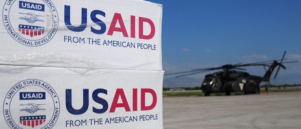
USAID Quietly Sent Thousands Of Viruses To Chinese Military-Linked Biolab

Trump’s One Big Beautiful Bill Resets The Energy Policy Playing Field
-
MAiD1 day ago
Canada’s euthanasia regime is already killing the disabled. It’s about to get worse
-
Daily Caller11 hours ago
USAID Quietly Sent Thousands Of Viruses To Chinese Military-Linked Biolab
-
 Alberta8 hours ago
‘Far too serious for such uninformed, careless journalism’: Complaint filed against Globe and Mail article challenging Alberta’s gender surgery law
-
 Censorship Industrial Complex19 hours ago
Canadian pro-freedom group sounds alarm over Liberal plans to revive internet censorship bill
-
 Fraser Institute1 day ago
Before Trudeau average annual immigration was 617,800. Under Trudeau number skyrocketted to 1.4 million from 2016 to 2024
-
 Daily Caller2 days ago
‘I Know How These People Operate’: Fmr CIA Officer Calls BS On FBI’s New Epstein Intel
-
 International2 days ago
Chicago suburb purchases childhood home of Pope Leo XIV
-
 Economy1 day ago
The stars are aligning for a new pipeline to the West Coast