History
Paul’s trip to the Western side of the Treasure State – Part 1 (Alberta radio personality and history enthusiast shares one-of-a-kind experience)
Needing to escape before I potentially had a new job, I decided in the 11th hour that I was going to take my camera, my new (to me) Jetta and both my US/CAN passports, to access the Treasure State.
My goal was to witness some of the Milwaukee Road structures still in place built during the 1909 Pacific Extension, and photograph their existence. I have long wanted to witness some of the treasures that you can find in Montana of the former CMStP&P main line.
Knowing that I only had 4 days, I decided to focus on a region, rather than try to see the line in a linear fashion of Harlowton-Saint Paul Pass. Instead, I decided to focus on Missoula-West to the Idaho line, and then use some of my allotted vacation time to stay in the Flathead for some GN heritage, now under the flag of the BNSF.
After choosing my starting point to be Missoula, I planned my routing to enter the state North of Cut Bank, and travel along the Front Range to Augusta, then cross the mountains on Highway 200 and end up in Missoula.
As I was heading along the corridor served by Highway 89, I wanted to try and locate any existing GN and MILW heritage along this route.
Day 1: Monday- Alberta/Montana Border-Missoula
I left Edmonton on a Sunday, and overnighted in Lethbridge, opting to cross into MT at the Del Bonita border crossing. The crossing was uneventful, and I stopped for my first photo at the end of the Valier branch, the former Montana Western Railway shortline built from Conrad to its terminus at Valier.
I shot the end of track and the elevators, and also noted that the town of Valier had a “Ponoka Avenue”, a nod to Indian heritage. Ponoka is the Blackfoot word for elk.


I went west to US89, where I followed it south-easterly along the eastern front of the Rockies, more or less obliterated by forest fire smoke.
A few miles from the hamlet of Pendroy, I encountered the former grade. To my knowledge this was GN’s line, as more or less a few miles to the East was Agawam, served by the Milwaukee Road. This was the furthest NW Milwaukee Road Northern Montana Division went, deep into GN served territory, the line ending at Agawam.
I was able snap a few shots of the grade and followed it through Bynum, Koyl and into Choteau.


Choteau:
At Choteau I was keen to find any remnants of the GN and the MILW’s history. The trains still come into Choteau by way of Power and Eastham Jct, now served by the BNSF.
The Great Northern Railway has family history for my mom’s side; my great uncle Justus Jern was the agent in Choteau at one time. I was hoping to see if the depot was still standing, but sadly it was razed some time ago. Downtown there is two visible lines, and the former MILW/GN joint main seems to be repositioned as an elevator loading track.
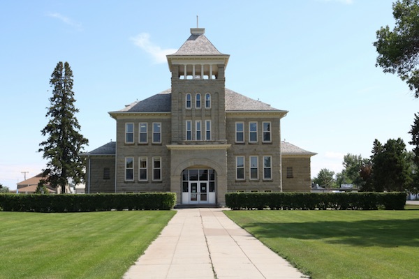
I got some photos of Choteau’s pretty downtown with the courthouse at the southern end of Mainstreet acting as the hub of the HWY 89/287 Traffic circle.


I needed to make my way to Missoula, so following Highway 287 led me toward Augusta.
Augusta:
Augusta, like Choteau is in scenic “prairie-meets-mountains” setting, and was at the Western end of a GN branch from Simms, parts of which were also used by the MILW in history. I recall there was a depot the last time I was through the region in 2002, but I didn’t see it if it was there. My research shows that the GN came into the nearby hamlet of Gilman, just a mile or so before Augusta’s townsite.

After Augusta I drove along the ever-undulating terrain, the hills and mountain vistas getting grander the closer I got to Highway 200 junction.
Through Rogers Pass:
Highway 200 is a lonely road. It’s also the longest state highway in the nation, running from the ND state line at Fairview 706 miles west to the Idaho border at Lake Pend Oreille. In places it runs across the least populated regions of Montana, and the segment from near Augusta to Missoula is a beautiful drive.
The mountains really begin to rise as you climb up to Rogers Pass. Yes, another Rogers Pass; named after the same A.B. Rogers, who’s name also graces the better-known pass in the Canadian Rockies. This pass has never had rail traffic, yet is the only pass South of Marias Pass that you can cross the divide, so it is an important corridor.

Rogers Pass to Missoula:
On the Western side of the divide the terrain changes into lush forests, and remote towns like Lincoln (the one-time home of the Unabomber), Ovando and Greenough. You travel along the edge of the Bob Marshall Wilderness area, and traffic is light on this scenic drive.
After Greenough, I was able to see some remains of the one-time line from Bonner (E. of Missoula) into the region.
Built as the Missoula & Bitter Root Valley Railroad, the line followed the Blackfoot River into the interior, and the grade was clearly visible in many spots. Especially just before arriving at Milltown, where the MRL was using a short portion to service the industry there. Bonner is a company town, and a found a great row of 1920’s Craftsman Houses. Many have been kept up.
Missoula was my first of two nights on the road, so I checked into my hotel and rested up for my second day- chasing the ghosts of the Milwaukee Road’s Electrified Pacific Extension to Puget Sound.
Day 2: Tuesday- Missoula-Saint Paul Pass/Lookout Pass
I had been in contact with Jon Severson, who has explored a lot of the MILW main line and even managed to access the remote, and very difficult to enter (due to private property) of Sixteen Mile Canyon, between Harlowton and Lombard. Since my car wasn’t a four-wheel drive, I had made the choice to explore the easier to follow grades that roughly parallel I-90. His advice was to explore the former MILW grade, most of it easily accessible from the frontage roads and former sections of Highway 10.
Lozeau and The Yellowstone Trail:
After a coffee, I hit I-90 West, and did a straight shot (easy to when the limit is 80 MPH) until Lozeau, just a little west of Alberton.
After exiting, I took a shot of the MRL (former NP) grade crossing at Lozeau and then crossed the unique single lane, wooden deck platformed truss bridge over the Clark Fork River and immediately met up with the former MILW grade and Old Highway 10.


Following old Highway 10, the “Yellowstone Trail” with roots to the Mullan Road (the original Wagon Road) is a scenic drive in itself. For the most part the road follows the MILW grade, and also parallel to the MRL’s former NP Mainline. I was on the “Mainstreet of the Northwest”!
It wasn’t long before I was rewarded one of MILW’s concrete bridges. Keystone Road’s underpass has since lost the center span.
I took shots of scenic Superior, MT, and then hopped back onto I-90 and highballed straight to Saltese.


Saltese, Lookout Pass, Saint Paul Pass:
Saltese has the scenic high bridge of the MILW grade. At this point climbing up towards the summit and tunnel through Saint Paul Pass.
The bridge at Saltese is now open for trail traffic, and is unofficially part of the “Route of The Hiawatha Trail”. A few miles upgrade the official trail head begins for the 15-mile ride through the 1.7-mile-long tunnel at East Portal through to Pearson, Idaho.
It’s worthy to note that the MILW wasn’t the only railroad in this narrow valley region. The NP had a branch line running from Sant Regis over Lookout Pass and into Wallace, Idaho. Much of the old NP route is somewhat accessible, and I can say I drove on a portion of it into Idaho at Lookout Pass.
Also, part of the scene is the old Highway 10 grade, and the newer I-90. I drove a few miles of the former Highway 10 on the Montana side of Lookout Pass. I ran into huckleberry pickers along the road. Most were expressing their distaste for the lack of huckleberries, the weather was hotter than normal, and the crop wasn’t excellent.


Saint Regis & Cyr:
I began to work my way home towards Missoula. I stopped at Saint Regis to photograph the bridges over the Clark Fork River. The Former MILW used to cross over the NP, just above the NP’s depot. The NP depot is gone, but the lanes of I-90 cross overhead.
Near Cyr Montana I captured the old Highway 10’s Spring Gulch bridge, right next to the old highway grade is the MILW grade. The bridge is now gone.


As I was driving into Alberton, my scanner went off, and on the opposite side of the valley was a BNSF coal train on the MRL. I retreated the 9 miles back to Cyr and found a crossing where I could get a pic of the power. A Santa Fe Warbonnet, with a FXE unit trailing. It was worth the chase. Otherwise, the MRL was pretty quiet on this day.
Alberton:
Alberton was the division point for the MILW. The previous one was Deer Lodge, and the next one would be Avery, Idaho.
Alberton was by every sense a true Milwaukee Road Town. The depot has been saved and acts as a library and other functions. The yard is gone, but you can see where it was, and a preserved Milwaukee Road built ribbed Bay window Caboose (these were built with passenger car trucks) and a former wooden baggage car are saved and on display nearby.


From Alberton I drove the old Highway 10 and at the former site of Soudan the incredible concrete structures carried the MILW over the road. The section over the highway has been removed, but the other segments still stand, resplendent as ruins by the Romans.
Just before Huson, the old Highway 10 peters out and you are back on I-90 through Frenchtown. Here, I jumped off the Interstate and found myself on the old Mullan Road (here numbered as Highway 263) and closely paralleled the MILW into Missoula.


Just 9 miles from Missoula is the former station of Primrose.
Primrose Substation:
Primrose has one of the surviving electric substations that powered the Milwaukee Road’s 438 miles of electric lines between Harlowton, MT to Avery, ID.
There were 14 substations along the right of way to keep the 3000 DC current flowing into the catenary that powered Box cab Electrics, Bi-Polars and Little Joe locomotives that pulled freight and passengers alike- notably the Olympian Hiawatha’s service from Chicago to Puget Sound. There are a few substations still standing in Montana, and others still in Washington between Othello and the Coast.
It was great to see a substation, and I knew I had to see two more structures before the end of the day, so into Missoula I went.


Milwaukee Road in Missoula:
Missoula is home to the University of Montana, headquarters of Montana Rail Link, a city bathed in history and also one of the most scenic small cities in the Pacific Northwest.
Missoula’s railroad heritage goes to the Northern Pacific, establishing a yard and division point and firmly in place by the time The Milwaukee Road entered the scene. The Milwaukee Road’s route from the East ran through Hellgate Canyon, past the University, and their depot was constructed just off Higgins Avenue, along the Clark Fork River. The Milwaukee Road’s larger depots were nothing like you would see in the West. The depot in Missoula was constructed in 1910, and was used by the railroad as a passenger terminal through 1960, after the cancellation of the Olympian Hiawatha and all other passenger trains on this extension. The railroad retained the building to house freight operations until the railroad went bankrupt in 1980.
After a few unsuccessful attempts to use the depot as a restaurant it was restored to house the Boone & Crockett Club as their headquarters, after being in the East for 105 previous years.
My final salute to the Milwaukee Road was to walk a short portion of the “Milwaukee Road Trail”, a paved trail that passes the depot and runs along the scenic Clark Fork River. I followed the trail to the U of M campus where two block signals still stand today, adjacent to the U of M’s Washington/Grizzlies Stadium.
I tried to imagine Little Joes and later EMD power running past the stadium during Griz’ games.
The trail is popular with Missoulians and I was happy to see that the rail – trail celebrated the era of being a transcontinental railroad.


It was my last night in Missoula, so I found a nice dinner at the Thomas Meager Pub in downtown Missoula and prepared for my trip up to the Flathead. More in Part 2!
February 14, 2025 – Alberta, Canada – A compelling new documentary, Cooking with Hot Stones: 200th Anniversary of Fort Assiniboine, is set to air on Wild TV, RFD TV Canada, Cowboy Channel Canada, and you can click here to stream for FREE on Wild TV’s streaming service, Wild TV+. This engaging one-hour feature will take viewers on a journey through time, exploring Fort Assiniboine’s rich history from 1823 to 2023.
Fort Assiniboine is a significant landmark in Alberta, playing a crucial role in Indigenous history, the fur trade, and the western expansion of Canada. This documentary captures the spirit of the region, illustrating how it has evolved over two centuries and how it continues to shape the cultural fabric of the province today.
Wild TV will make the documentary free to stream on Wild TV+ (insert link here once push it over to app) on February 14th so that it can be easily accessed in classrooms and other educational settings throughout the region, ensuring the historical significance of Fort Assiniboine reaches a wider audience.
Produced by Western Directives Inc., Cooking with Hot Stones: 200th Anniversary of Fort Assiniboine brings historical moments to life with vivid storytelling, expert interviews, and breathtaking cinematography.
“We are very excited to partner with Wild TV as part of our one hour documentary production. Based in Alberta, we respect the hard work and quality programming that Wild TV brings to a national audience. With the broadcast opportunity, Wild TV gives our production the ability to entertain and educate Canadians across the country on multiple platforms,” said Tim McKort, Producer at Western Directives.
Scott Stirling, Vice President of Wild TV, also expressed enthusiasm for the project: “At Wild TV, we are passionate about telling Canadian stories that resonate with our audiences. This documentary not only highlights a crucial piece of our nation’s history but also celebrates the resilience and contributions of Indigenous peoples, traders, and settlers who shaped the land we call home today. We are proud to bring Cooking with Hot Stones: 200th Anniversary of Fort Assiniboine to our viewers across Canada.”
Airtimes for Wild TV can be found here.
For airtimes on RFD TV Canada, click here.
For airtimes on Cowboy Channel Canada, visit CCC’s schedule.
Frontier Centre for Public Policy
Hungarian Revolution of 1956: A Valiant Effort to Overthrow Communist Rule
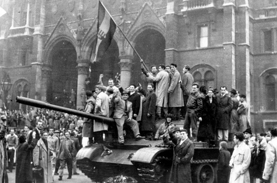
Civilians wave Hungary’s national flag from a captured Soviet tank in Budapest’s main square during the anti-communist uprising of October 1956. AP Photo
From the Frontier Centre for Public Policy
By Gerry Bowler
For a time, Moscow seemed willing to accept change in Hungary, but when Nagy announced that his country would leave the Warsaw Pact and become neutral in the Cold War, that was a bridge too far for Khrushchev.
After World War II ended in the summer of 1945, the Soviet Red Army found itself to be in possession of Eastern Europe. In the next few years, the USSR extinguished the young democracies in Poland, Czechoslovakia, Romania, Latvia, Lithuania, and Estonia, while imposing Stalinist governments on autocracies such as Bulgaria and Hungary. With Marxist regimes taking over in eastern Germany, and Albania and Yugoslavia as well, Winston Churchill spoke truly when he said that “from Stettin the Baltic to Trieste in the Adriatic, an iron curtain has descended across the continent.”
In many of these countries, there was considerable resentment over the Russian occupation. In the Baltic republics, Romania, Croatia, Belarus, Poland, and Ukraine, doomed anti-Soviet guerilla movements with names like the “Forest Brothers,” the “Cursed Soldiers,” or “Crusaders,” fought underground wars that\ lasted for years. In June 1953 in East Berlin, workers rose up in protests against their communist masters, sparking a short-lived rebellion that spread to hundreds of towns before being crushed by Russian tanks. The most serious of these insurrections was the Hungarian Revolution of 1956. By 1956, there were stirrings of discontent in the Hungarian People’s Republic. Under the state control of industry, forced agricultural collectivization, and the shipping of produce to the Soviet Union, the economy was in bad shape. The supply of consumer goods was low and standards of living were dropping. Secret police surveillance of the population was harsh, while many Hungarians resented the suppression of religion and the mandatory instruction of the Russian language in schools. As news leaked out about Soviet Premier Nikita Khrushchev’s denunciation of Stalin in the so-called “Secret Speech,” hopes grew that reform of the communist system was possible.
Marxist intellectuals began to form study circles to discuss a new path for Hungarian socialism, but their cautious proposals were suddenly overtaken by demands for change by young people. On Oct. 22, 1956, students at the Technical University of Budapest drew up a list of demands for change known as the “Sixteen Points.” They included free elections, a withdrawal of Soviet troops, free speech, and an improvement in economic conditions.
On the afternoon of the next day, these points were read out to a crowd of 20,000 who had gathered at the statue of a leader of the Hungarian rebellion of 1848. By 6 p.m., when the students marched on the Parliament Building, the crowd had grown to around 200,000 people. This alarmed the government, and later that evening Communist Party leader Erno Gero took to the radio to condemn the Sixteen Points. In reaction, mobs tore down an enormous statue of Stalin.

People surround the decapitated head of a huge statue of Josef Stalin in Budapest during the Hungarian Revolution in 1956. Daniel Sego (second L), who cut off the head, is spitting on the statue. Hulton Archive/Getty Images
On the night of Oct. 23, crowds gathered outside the state broadcaster, Radio Budapest, to demand that the Sixteen Points be sent out over the air. The secret police fired on the protesters, killing a number of them. This enraged the demonstrators who set fire to police cars and seized arms from military depots. Army units ordered to support the secret police rebelled and joined the protest. The government floundered; on the one hand, they called Soviet tanks into Budapest; on the other hand, they appointed Imre Nagy, seen as a popular reformer, as prime minister.
As barricades were being erected by protesters and shots were being exchanged with secret police units, Nagy was negotiating with the Soviets who agreed that they would withdraw their tanks from the capital. Over the next few days, the rebellion spread; factories were seized, Communist Party newspapers and headquarters were attacked, and known communists and secret police agents were murdered. The new prime minister released political prisoners and promised the establishment of democracy, with freedom of speech and religion.
For a time, Moscow seemed willing to accept change in Hungary, but when Nagy announced that his country would leave the Warsaw Pact and become neutral in the Cold War, that was a bridge too far for Khrushchev. Fearing the collapse of the entire Soviet bloc, he made plans for an invasion of Hungary. By Nov. 3, the Red Army had surrounded Budapest, and the next day heavy fighting erupted as armoured columns entered the city. Some units of the Hungarian army fought back, joined by thousands of civilians, but the end was predictable. After a week of battles, with over 20,000 dead and wounded, resistance crumbled. A new Soviet-approved government under János Kádár purged the army and Communist Party, arrested thousands, and executed rebel leaders including Nagy.
Hundreds of thousands of refugees fled, many of them settling in Canada and the United States. World condemnation of the USSR was strong; critics of the Soviets included many communists in the West who resigned their party membership. Not until the collapse of the Soviet hold on Eastern Europe in 1989 did Hungarians get another taste of freedom.
Published in the Epoch Times.
Gerry Bowler, historian, is a Senior Fellow at the Frontier Centre for Public Policy.
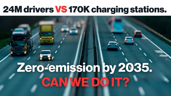
Power Struggle: Electric vehicles and reality
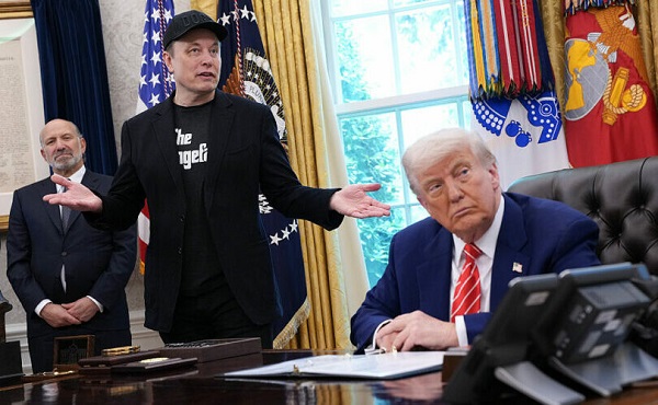
Elon Musk slams Trump’s ‘Big Beautiful Bill,’ calls for new political party
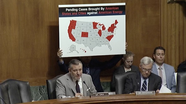
China undermining American energy independence, report says

National Health Care Fraud Takedown Results in 324 Defendants Charged in Connection with Over $14.6 Billion in Alleged Fraud
Trump on Canada tariff deadline: ‘We can do whatever we want’

RFK Jr. Unloads Disturbing Vaccine Secrets on Tucker—And Surprises Everyone on Trump
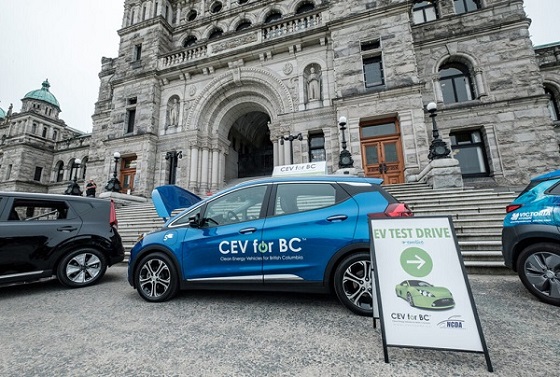
Electric vehicle sales are falling hard in BC, and it is time to recognize reality.
-
 armed forces1 day ago
Canada’s Military Can’t Be Fixed With Cash Alone
-
 Business1 day ago
Canada’s loyalty to globalism is bleeding our economy dry
-
 Alberta1 day ago
Alberta Next: Alberta Pension Plan
-
 Alberta1 day ago
COVID mandates protester in Canada released on bail after over 2 years in jail
-
 International1 day ago
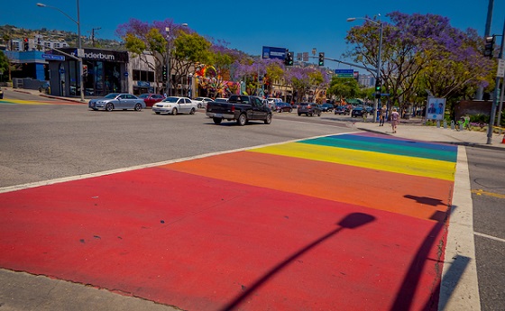
Trump transportation secretary tells governors to remove ‘rainbow crosswalks’
-
 Crime2 days ago
Project Sleeping Giant: Inside the Chinese Mercantile Machine Linking Beijing’s Underground Banks and the Sinaloa Cartel
-
 Alberta2 days ago
Alberta uncorks new rules for liquor and cannabis
-
 Business1 day ago
Carney’s spending makes Trudeau look like a cheapskate