weather
Tornado hits Havana; Cuban president says 3 dead, 172 hurt
HAVANA — A tornado and pounding rains smashed into the eastern part of Cuba’s capital overnight, toppling trees, bending power poles and flinging shards of metal roofing through the air as the storm cut a path of destruction across eastern Havana.
Power was cut to many areas and President Miguel Diaz-Canel said Monday at least three people were killed and 172 injured.
Julio Menendez, a 33-year-old restaurant worker said Havana’s 10 de Octubre borough “looks like a horror movie.”
“From one moment to the next, we heard a noise like an airplane falling out of the sky. The first thing I did was go hug my daughters,” who are 9 and 12, he told The Associated Press.
Driver Oster Rodriguez said that amid a fierce storm, what looked like a thick, swirling cloud touched down in the central plaza of the Reparto Modelo
The windows in the seven-story Daughters of Galicia Hospital had been sucked out of their frames by the wind, leaving curtains flapping in the breeze, and all the patients, new and expectant mothers, had to be evacuated. In the streets, a palm tree more than 30 feet (9
Photos posted on Twitter by Havana residents showed cars crushed by fallen light posts and cars trapped in floodwaters around the city. The
Leanys Calvo, a restaurant cook in the 10th of October borough, said she was working Sunday night despite heavy rain and wind when she heard a rumbling noise outside and looked out to see what appeared to be a tornado touching down.
“It was something that touched down, and then took off again. It was like a tower,” she said, describing it as displaying
The Associated Press
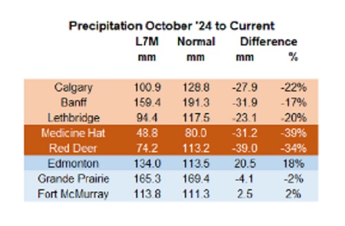

Below are my updated charts through April 2025 along with the cumulative data starting in October 2024. As you can see, central and southern Alberta are trending quite dry, while the north appears to be faring much better. However, even there, the devil is in the details. For instance, in Grande Prairie the overall precipitation level appears to be “normal”, yet in April it was bone dry and talking with someone who was recently there, they described it as a dust bowl. In short, some rainfall would be helpful. These next 3 months are fairly critical.
 |
Thanks for reading William’s Substack!
Subscribe for free to receive new posts and support my work.
From the Daily Caller News Foundation
![]()
By Hailey Gomez
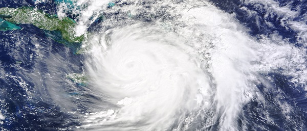
Hurricane Milton officially made landfall near Siesta Key, Florida, on Wednesday night as local residents have either bunkered down or fled from the areas expected to be hit, according to the National Hurricane Center.
Dropping from a Category 4 to Category 3 storm right before landfall, the devastating storm had 120 mph sustained winds and higher gusts, the National Hurricane Center reported. Warnings about Hurricane Milton began early in the week, with lawmakers and officials urging residents within Florida’s Gulf Coast area to flee from their homes or be prepared for disastrous impacts, according to The Associated Press News.
“As Hurricane Milton makes landfall near Sarasota county, now is the time to shelter in place. First responders are staged and ready to go, as soon as weather conditions allow. Search and rescue efforts will be well underway to save lives before dawn, and they will continue for as long as it takes,” Republican Florida Gov. Ron DeSantis posted to X.
An estimated 2 million people, including those within the Tampa, St. Petersburg and Clearwater, Florida, area, were under a flash-flood warning from the Tampa National Weather Service, as “between 6 and 12 inches of rain” had already fallen.
Violent videos of the storm have began to circulating on X showing powerful winds tearing apart homes, trees and power lines.
BREAKING: Multiple people dead following tornado outbreak from Hurricane Milton in St. Lucie County, Florida, local media reports#HurricanMilton #miltonhurricane #Milton #StormFootage #FloridaStorm https://t.co/EoMxODqfuV pic.twitter.com/UrMEsXE22j
— Smriti Sharma (@SmritiSharma_) October 10, 2024
Early reports indicated fatalities occurred due to tornado touchdowns prior to landfall on Florida’s Atlantic coast, according to West Palm Beach-based affiliate WPTV. While details remain unclear about the deceased, St. Lucie County Sheriff Keith Pearson confirmed to the outlet “multiple people” have been killed.
The storm comes on the heels of Hurricane Helene, a Category 4 storm, which resulted in the deaths of over 200 people as it ripped through North Carolina, Georgia, South Carolina, Tennessee and Virginia after first making landfall in Florida on the evening of Sept. 26.

COWBOY UP! Pierre Poilievre Promises to Fight for Oil and Gas, a Stronger Military and the Interests of Western Canada
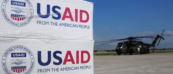
USAID Quietly Sent Thousands Of Viruses To Chinese Military-Linked Biolab

Canada’s euthanasia regime is already killing the disabled. It’s about to get worse
‘Far too serious for such uninformed, careless journalism’: Complaint filed against Globe and Mail article challenging Alberta’s gender surgery law
-
 Bruce Dowbiggin2 days ago
The Covid 19 Disaster: When Do We Get The Apologies?
-
 Crime1 day ago
Sweeping Boston Indictment Points to Vast Chinese Narco-Smuggling and Illegal Alien Labor Plot via Mexican Border
-
 Alberta2 days ago
Alberta school boards required to meet new standards for school library materials with regard to sexual content
-
 Environment1 day ago
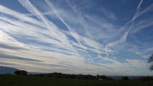
EPA releases report on chemtrails, climate manipulation
-
 Business15 hours ago
Trump slaps Brazil with tariffs over social media censorship
-
 International16 hours ago
Support for the Ukraine war continues because no one elected is actually in charge.
-
 Addictions18 hours ago
Can addiction be predicted—and prevented?
-
 espionage11 hours ago
FBI’s Dan Bongino may resign after dispute about Epstein files with Pam Bondi