weather
Strongest earthquake in 20 years rattles Southern California

LOS ANGELES — The strongest earthquake in 20 years shook a large swath of Southern California and parts of Nevada on the July 4th holiday, rattling nerves and causing injuries and damage in a town near the epicenter, followed by a swarm of ongoing aftershocks.
The 6.4 magnitude quake struck at 10:33 a.m. Thursday in the Mojave Desert, about 150 miles (240
Multiple injuries and two house fires were reported in the town of 28,000. Emergency crews were also dealing with small vegetation fires, gas leaks and reports of cracked roads, said Kern County Fire Chief David Witt.
He said 15 patients were evacuated from the Ridgecrest Regional Hospital as a precaution and out of concern for aftershocks.
Kern County District Supervisor Mick Gleason told CNN there were some structural issues with the hospital and some patients had to be moved from one ward to another and that others were taken to a
Gleason did not say what the structural issues were.
Ridgecrest Mayor Peggy Breeden said that utility workers were assessing broken gas lines and turning off gas where necessary.
The local senior
“Oh, my goodness, there’s another one (quake) right now,” Breeden said on live television as an aftershock struck.
Gov. Gavin Newsom declared a state of emergency for Kern County. The declaration means that the state will help the county and municipalities in it with emergency aid and recovery efforts.
Ridgecrest Mayor Peggy Breeden praised Newsom for declaring the emergency. She also noted at a news conference that other nearby governments have offered to help the recovery effort.
President Donald Trump said he was fully briefed on the earthquake and that it “all seems to be very much under control!”
Police and fire officials said at a news conference Thursday afternoon that they have enough resources so far to meet needs in the wake of the earthquake. Ridgecrest Police Chief Jed McLaughlin said at a news conference that “we have plenty of resources.”
California Highway Patrol Lt. John Williams says officials have found cracks on several roads in the county, but overpasses and underpasses are in good shape.
A series of aftershocks included a 4.5 magnitude temblor, according to the United States Geological Survey.
“It almost gave me a heart attack,” said Cora Burke, a waitress at Midway Cafe in Ridgecrest, of the big jolt. “It’s just a rolling feeling inside the building, inside the cafe and all of a sudden everything started falling off the shelf, glasses, the refrigerator and everything in the small refrigerator fell over.”
Video posted online of a liquor store in Ridgecrest showed the aisles filled with broken wine and liquor bottles, knocked down boxes and other groceries strewn on the floor. Flames were seen shooting out of one home in the community.
Lucy Jones, a seismologist with the California Institute of Technology’s seismology lab, said the earthquake was the strongest since a 7.1 quake struck in the area on October 16, 1999.
“This has been an extremely quiet abnormal time,” Jones said. “This type of earthquake is much more normal … The long term average is probably once every five or 10 years somewhere in Southern California.”
Jones said that the 6.4 quake
She said vigorous aftershocks were occurring and that she wouldn’t be surprised if a magnitude 5 quake hit but that they were striking in a remote area, sparsely populated area. “This is an isolated enough location that that’s going to greatly reduce the damage,” she said.
People from Las Vegas to the Pacific Coast reported feeling a rolling motion and took to social media to report it.
Local emergency agencies also took to social media to ask people to only call 911 for emergencies.
“We are very much aware of the significant earthquake that just occurred in Southern California. Please DO NOT call 9-1-1 unless there are injuries or other dangerous conditions. Don’t call for questions please,” the LAPD said in a statement published on Twitter.
There were no reports of serious damage or injuries in Los Angeles, the department said.
The quake was detected by California’s new ShakeAlert system and it provided 48 seconds of warning to the seismology lab well before the shaking arrived at Caltech in the Los Angeles suburb of Pasadena but it did not trigger a public warning through an app recently made available in Los Angeles County.
USGS seismologist Robert Graves said the ShakeAlert system worked properly.
Graves said it calculated an intensity level for the Los Angeles area that was below the threshold for a public alert. The limits are intended to avoid false alarms.
Ashleigh Chandler, a helicopter rescue EMT at Fort Irwin, California, said the quake happened as she was getting ready for a July 4th party.
“I was just in the living room getting everything ready, we start to feel the shaking, so then I look up and then the wine bottles start rattling and I thought, ‘They’re going to fall.’
“My stepson was in the house and my dog, so we just got everyone outside and then it ended. It was like 15, 20 seconds, maybe. It was pretty good shaking, so I’m out of breath.”
“Everyone’s OK.”
Glenn Pomeroy, the head of California’s Earthquake Authority, said the earthquake is “an important reminder that all of California is earthquake country.”
Pomeroy urged the estimated 2,000 people in the region hit by the quake who have California Earthquake Authority insurance policies to contact their residential insurance agencies as soon as possible. Information on how to file a policy claim is on the agency’s
___
Rodriguez reported from San Francisco. Associated Press writer Rachel Lerman in San Francisco and AP Radio reporter Shelly Adler in Washington, D.C., contributed.
John Antczak And Olga R. Rodriguez, The Associated Press
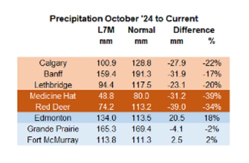

Below are my updated charts through April 2025 along with the cumulative data starting in October 2024. As you can see, central and southern Alberta are trending quite dry, while the north appears to be faring much better. However, even there, the devil is in the details. For instance, in Grande Prairie the overall precipitation level appears to be “normal”, yet in April it was bone dry and talking with someone who was recently there, they described it as a dust bowl. In short, some rainfall would be helpful. These next 3 months are fairly critical.
 |
Thanks for reading William’s Substack!
Subscribe for free to receive new posts and support my work.
From the Daily Caller News Foundation
![]()
By Hailey Gomez
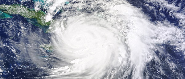
Hurricane Milton officially made landfall near Siesta Key, Florida, on Wednesday night as local residents have either bunkered down or fled from the areas expected to be hit, according to the National Hurricane Center.
Dropping from a Category 4 to Category 3 storm right before landfall, the devastating storm had 120 mph sustained winds and higher gusts, the National Hurricane Center reported. Warnings about Hurricane Milton began early in the week, with lawmakers and officials urging residents within Florida’s Gulf Coast area to flee from their homes or be prepared for disastrous impacts, according to The Associated Press News.
“As Hurricane Milton makes landfall near Sarasota county, now is the time to shelter in place. First responders are staged and ready to go, as soon as weather conditions allow. Search and rescue efforts will be well underway to save lives before dawn, and they will continue for as long as it takes,” Republican Florida Gov. Ron DeSantis posted to X.
An estimated 2 million people, including those within the Tampa, St. Petersburg and Clearwater, Florida, area, were under a flash-flood warning from the Tampa National Weather Service, as “between 6 and 12 inches of rain” had already fallen.
Violent videos of the storm have began to circulating on X showing powerful winds tearing apart homes, trees and power lines.
BREAKING: Multiple people dead following tornado outbreak from Hurricane Milton in St. Lucie County, Florida, local media reports#HurricanMilton #miltonhurricane #Milton #StormFootage #FloridaStorm https://t.co/EoMxODqfuV pic.twitter.com/UrMEsXE22j
— Smriti Sharma (@SmritiSharma_) October 10, 2024
Early reports indicated fatalities occurred due to tornado touchdowns prior to landfall on Florida’s Atlantic coast, according to West Palm Beach-based affiliate WPTV. While details remain unclear about the deceased, St. Lucie County Sheriff Keith Pearson confirmed to the outlet “multiple people” have been killed.
The storm comes on the heels of Hurricane Helene, a Category 4 storm, which resulted in the deaths of over 200 people as it ripped through North Carolina, Georgia, South Carolina, Tennessee and Virginia after first making landfall in Florida on the evening of Sept. 26.

RFK Jr. says Hep B vaccine is linked to 1,135% higher autism rate

Blind to the Left: Canada’s Counter-Extremism Failure Leaves Neo-Marxist and Islamist Threats Unchecked
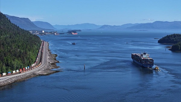
Why it’s time to repeal the oil tanker ban on B.C.’s north coast
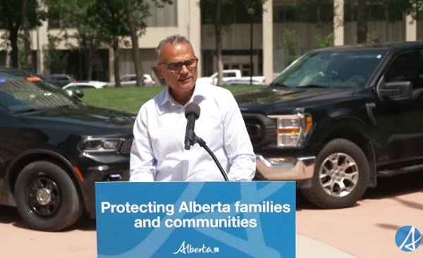
Alberta Provincial Police – New chief of Independent Agency Police Service
-
 Energy1 day ago
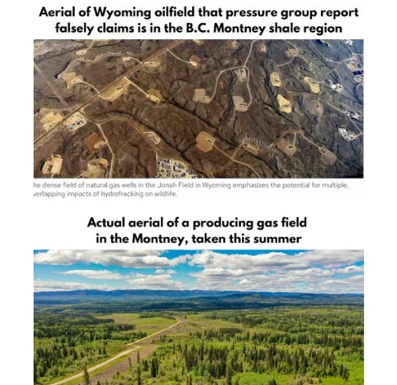
B.C. Residents File Competition Bureau Complaint Against David Suzuki Foundation for Use of False Imagery in Anti-Energy Campaigns
-
 Alberta2 days ago
Alberta uncorks new rules for liquor and cannabis
-
 COVID-191 day ago
Court compels RCMP and TD Bank to hand over records related to freezing of peaceful protestor’s bank accounts
-
 Crime2 days ago
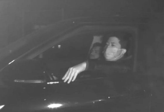
Project Sleeping Giant: Inside the Chinese Mercantile Machine Linking Beijing’s Underground Banks and the Sinaloa Cartel
-
 C2C Journal23 hours ago
Canada Desperately Needs a Baby Bump
-
 International1 day ago
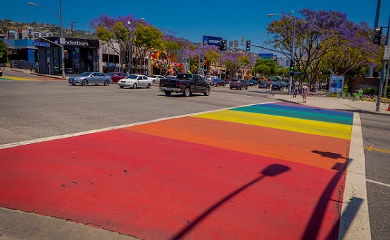
Trump transportation secretary tells governors to remove ‘rainbow crosswalks’
-
 Alberta1 day ago
Alberta Next: Alberta Pension Plan
-
 Agriculture11 hours ago
Lacombe meat processor scores $1.2 million dollar provincial tax credit to help expansion